Aerial Analysis and 3D Model Portfolio
Drone Pilots of St. Louis is excited to share a project portfolio of options, ideas, and potential deliverables.

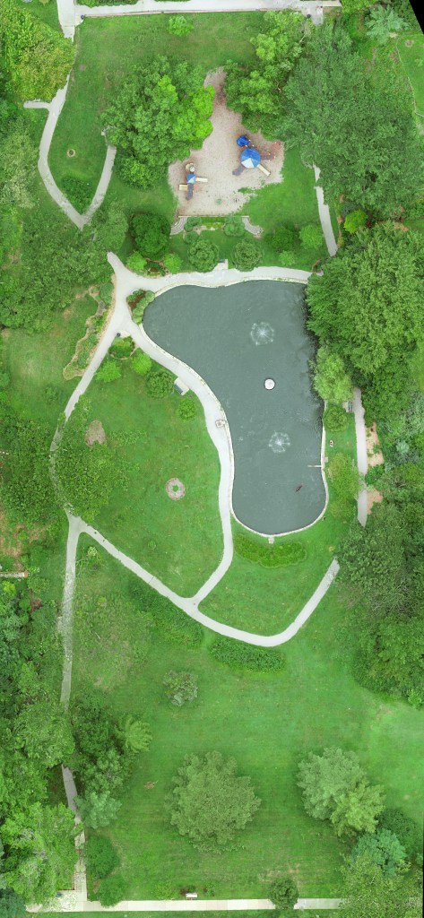
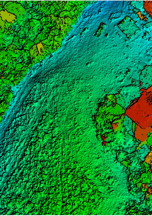
University City Parks
An ongoing project to provide a virtual experience to University City public parks
The U-City Park project brings a combination of aerial views, orthomosaics, elevation, and 3D models to viewers in an effort to share a virtual experience. This project is fully supported by Drone Pilots of St. Louis.
Experience the 3D view here.


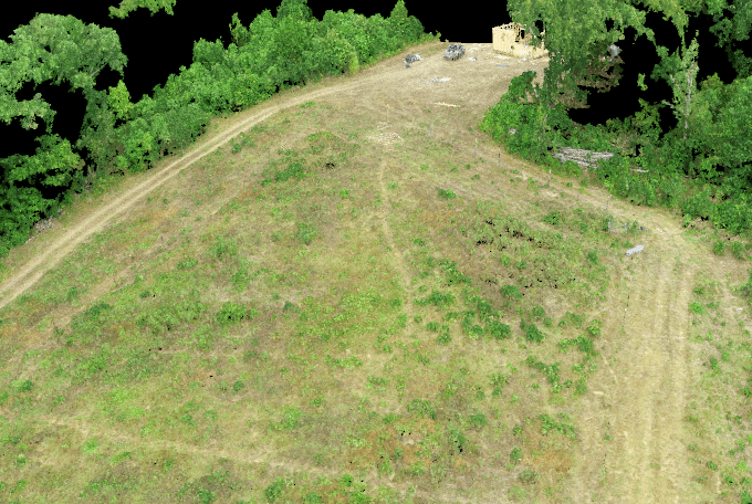
The Farm Project
This project showcases opportunities with agricultural and construction sectors.
We partner with East Prong Family Farms, LLC in Bonne Terre, Missouri to support their many development efforts. This is a collection of planning, construction progress monitoring, and marketing.
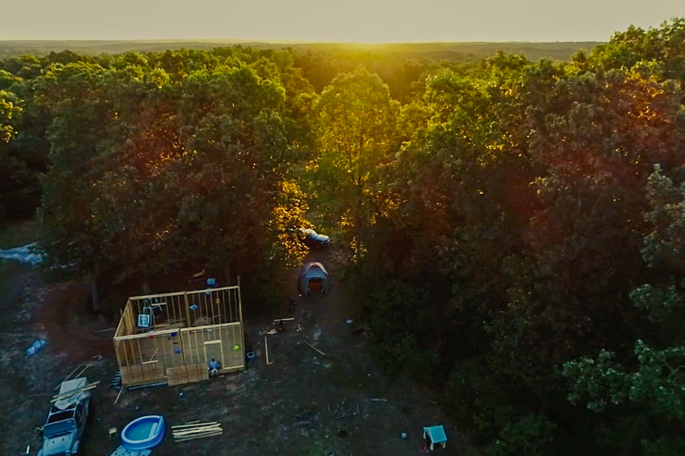


We don’t typically focus on marketing but we had enough material that we were able to add this to the farm’s drone service package. Drone Pilots of St. Louis is focused on providing customers with the fullest potential from every engagement.

St. Louis Parks Project showcases opportunities with 2D and 3D experiences.
The St. Louis Parks Project
Drone Pilots of St. Louis is excited to share 2D and 3D products. These showcase methods to bring experiences to anyone in any location.
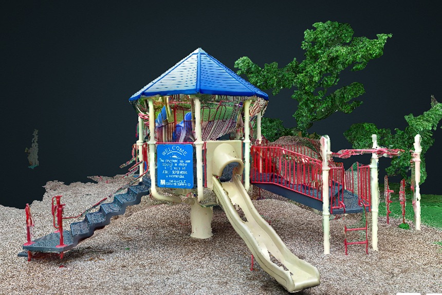
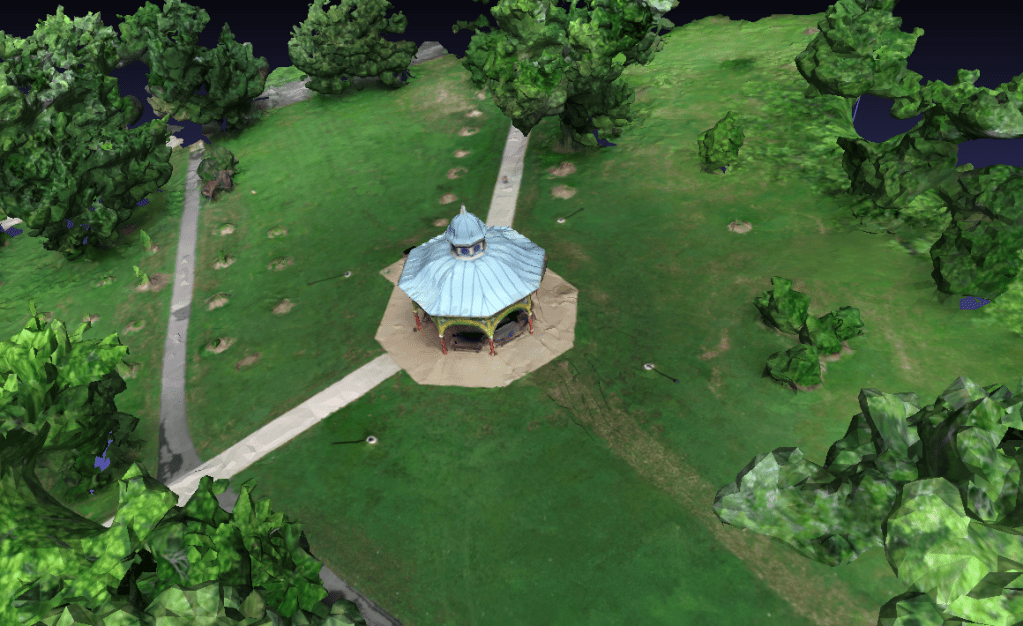
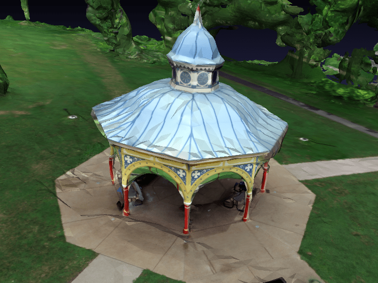
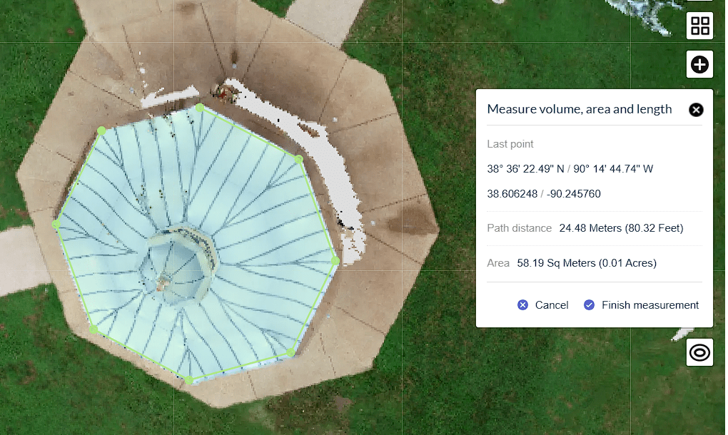
Tower Grove Park – Old Playground Pavilion
219 images transformed into a high-resolution orthomosaic, a 3D point cloud and a 3D model. Roof area measurements obtained from the model.

High Resolution Orthomosaic, just over 5 acres shown

Forest Park Preservation
The Forest Park Preservation Project seeks to preserve the experience in a 3-dimensional environment for generations beyond ours to enjoy.
Project underway. Forest Park portfolio coming soon!
