The development of a 3D model is all about data. Drone Pilots of St. Louis plans each job to ensure sufficient pictures are obtained. We may do grid flights that are further supported by orbital and/or free flight paths. The key is to obtain images that have sufficient overlap and to see everything that is to be modeled.
We then bring the images, full of data, back to our office for in-house processing. Drone Pilots of St. Louis runs a process to extract the data from the images. This data is then used to develop the 3D model.
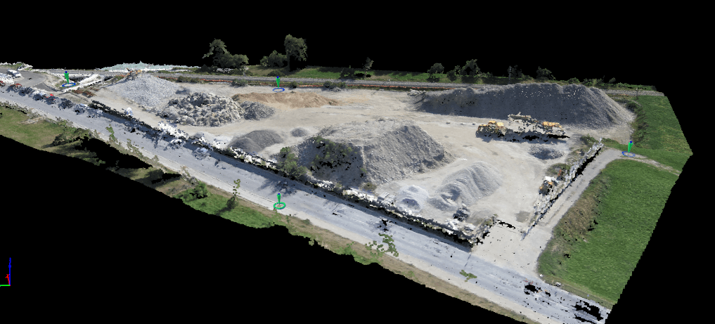
Aerial Photo Data
Each photo contains 20 million pixels. Think of a pixel as a small square in your image. 20 million of these square creates the image that is the whole picture. Each pixel contains data related to the position (elevation and distance relative to other pixels) and data that defines the color. Drone Pilots of St. Louis ensures overlapping images from multiple points to provide a high level of scale accuracy.

3D Model Development
After data extraction Drone Pilots of St. Louis then runs a process to convert that data to an image that is adjusted for depth and color based on the pixel data. This is then rendered in the 3D environment for the user to experience. We run this process in-house. The in-house process allows us to control for various factors to decrease any potential error rate.

Contact us today to discuss your next project. Drone Pilots of St. Louis is a company of Design Thinking Solutions, LLC, a woman- and minority-owned small business in St. Louis, Missouri, U.S.A.

Leave a comment